Neighborhoods and districts / Miami Beach
South Beach is the southern part of Miami Beach, a separate municipality from Miami. Its residential streets, hotel corridors and oceanfront public spaces developed through different phases of resort building and preservation. A metropolitan planning report treats South Beach as a neighborhood containing smaller areas, rather than as one historic district.[1]
Neighborhood and historic districts§
The planning report describes a neighborhood reaching from the southern inlet to a northern edge along Dade Boulevard, 23rd Street and connecting roads, between the Atlantic and the Intracoastal Waterway. It identifies smaller community areas, including Flamingo Park and South of Fifth. That study geography differs from the boundaries of individual architectural districts and from the narrower Ocean Drive corridor.[1]
A small-lot resort landscape§
The city’s 1995 Ocean Beach designation report traces an early development phase to the Lummus brothers’ Ocean Beach Realty Company. Their July 1912 plat established a street grid and relatively small lots intended for cottages and commerce. Later additions extended this southern settlement. The resulting scale differed from larger estate properties farther north, helping explain why a history of South Beach includes modest housing and neighborhood businesses alongside hotels. The report also describes an important difference in access: Ocean Beach did not impose the anti-Jewish sale and rental restrictions found in other early Beach developments. This is a historical account of unequal development practices, rather than a claim that resort life was equally accessible to everyone.[2]
Preservation as civic activity§
The Miami Design Preservation League dates its founding to 1976 and connects its advocacy with the architectural district’s 1979 National Register listing. Its institutional history describes later expansion of the recognized district in 1992. Preservation therefore involved successive campaigns and geographic changes. The league’s interpretive work also links building history with public tours, its Ocean Drive welcome center and Art Deco Weekend, connecting advocacy with ways residents and visitors encounter the streets.[3]
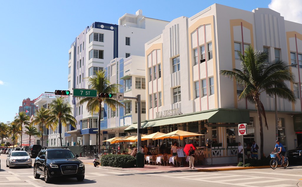
Cafés and the pedestrian street§
APA’s 2007 Ocean Drive profile describes a 1986 improvement plan that widened sidewalks for outdoor tables and paired mixed uses with a public promenade. It also raises the affordability of the revitalized area for lower-income retirees. Outdoor dining belongs within this broader story of street design, investment and housing, rather than serving only as an image of resort leisure.[4]
Oceanfront public space§
The city identifies Lummus Park along Ocean Drive from 5th Street to 14th Place, within its South Beach neighborhood. Its facility description combines paved paths, playgrounds and recreation areas with space used for larger public activities. The park and the adjoining café street form different kinds of gathering space: one is a municipal recreation landscape, while the other mixes pedestrian movement with commercial frontage. This is Miami Beach’s oceanfront Lummus Park, distinct from the similarly named park near the Miami River in the City of Miami.[5]
Sources & references
- South Beach community report, relevant pages 1–2 Miami-Dade MPO / FIU archive. Retrieved . ↑1↑2↑3
- Ocean Beach designation report, 1995, historical section City of Miami Beach. Retrieved . ↑
- Preservation League institutional history Miami Design Preservation League. Retrieved . ↑
- Ocean Drive planning profile, 2007 American Planning Association. Retrieved . ↑
- Lummus Park facility description City of Miami Beach. Retrieved . ↑1↑2